An analysis of current practices with emphasis on AI and GIS services from ClimateChic.cloud
Abstract
Forests are among the most critical planetary systems for climate regulation, biodiversity conservation, and ecosystem service provision. However, forest ecosystems worldwide are increasingly stressed by climate change, unsustainable exploitation, and landscape fragmentation. Traditional forest management approaches—largely dependent on field surveys and legacy Geographic Information Systems (GIS)—struggle to deliver timely, accurate, and scalable insights at landscape and regional levels. Recent advances in artificial intelligence (AI), geospatial analytics, and cloud computing signal a paradigm shift from episodic, labor-intensive assessments toward continuous, data-driven forest intelligence. This article examines the evolving role of AI and GIS in forestry, reviews key technological trends and applications, and situates the AI- and GIS-based offerings of ClimateChic.cloud within the broader ecosystem of forestry intelligence tools. It argues that AI-enabled forest monitoring and management, when coupled with scalable cloud-based GIS services, is transitioning from experimental research into operational deployment. ClimateChic.cloud is presented as an example of integrated, climate-smart forest analytics that supports evidence-based decision-making for sustainable forestry and climate adaptation.
Keywords
Artificial intelligence; forestry; geospatial artificial intelligence (GeoAI); geographic information systems (GIS); remote sensing; cloud computing; forest monitoring; climate-smart forestry; forest inventory; biomass and carbon estimation; land-cover change detection; decision support systems; climate adaptation; nature-based solutions; ClimateChic.cloud
- Introduction
Forests occupy approximately 31% of the Earth’s land surface and serve as essential carbon reservoirs, biodiversity refuges, and providers of ecosystem services such as watershed regulation, soil stabilization, and climate mitigation (FAO, 2020). In recent decades, climate change, land-use conversion, and intensified anthropogenic pressures have substantially increased the complexity of forest management. These pressures demand new tools capable of capturing forest dynamics across spatial and temporal scales that exceed the capacity of traditional methods.
In response, the forestry sector is increasingly turning to artificial intelligence (AI) and GIS technologies to enhance forest monitoring, model future scenarios, and support evidence-based interventions. AI—encompassing machine learning (ML), deep learning (DL), and pattern recognition—combined with spatial analysis, remote sensing, and cloud computing, allows managers to observe, analyze, and predict forest conditions at unprecedented resolution and frequency.
This integration has moved beyond experimental research and is now being operationalized by both public and private actors. Platforms such as ClimateChic.cloud exemplify this transition by offering AI- and GIS-driven services tailored to climate adaptation, forestry, and natural resource management.
This article explores the following objectives:
The theoretical and practical roles of AI and GIS in forestry
Current technological capabilities and limitations
The emerging landscape of cloud-based forestry analytics
A focused discussion on ClimateChic.cloud’s AI and GIS contributions
Future directions for AI-enabled forest intelligence
- The Need for AI and GIS in Modern Forestry
2.1 Limitations of Traditional Forestry Tools
Conventional forestry management relies heavily on ground-based surveys, permanent inventory plots, and manual interpretation of aerial photographs. While these approaches provide valuable site-level information, they present several limitations:
They are labor-intensive and costly, requiring extensive field personnel
They are spatially constrained, often extrapolating landscape conditions from sparse sample plots
They are temporally delayed, with inventory cycles that lag behind rapidly evolving disturbances
As a result, traditional tools struggle to support timely responses to events such as pest outbreaks, wildfires, drought-induced mortality, and illegal land-use change.
2.2 GIS and Remote Sensing as the Spatial Backbone
GIS has long provided the spatial framework for storing, analyzing, and visualizing forest data. When integrated with remote sensing technologies—including satellites, unmanned aerial vehicles (UAVs), LiDAR, and radar—GIS enables large-scale mapping of forest cover, structure, and disturbance patterns.
Modern GIS workflows incorporate multiple data layers, such as:
Land cover and land-use classifications
Topography, slope, and hydrology
Vegetation indices (e.g., NDVI, EVI)
Thermal anomalies and wildfire risk indicators
However, the volume and complexity of these datasets increasingly exceed the capacity of manual analysis, particularly as sensor resolution and revisit frequency continue to improve.
2.3 The Role of Artificial Intelligence
Artificial intelligence enhances traditional GIS workflows by automating data interpretation and enabling predictive analytics. In forestry, AI supports:
Automated feature extraction from high-resolution imagery
Predictive modeling of forest growth and disturbance patterns
Anomaly detection across extensive spatial extents
Integration of heterogeneous datasets, including climate, soil, and biological information
Through these capabilities, AI transforms forestry from primarily descriptive mapping to predictive, decision-oriented forest intelligence.
- Technological Foundations: AI and GIS for Forest Intelligence
3.1 Geospatial Artificial Intelligence (GeoAI)
Geospatial Artificial Intelligence (GeoAI) refers to the application of machine learning and advanced analytics to spatial data. GeoAI integrates spatial statistics, machine learning classifiers, and deep learning architectures—such as convolutional neural networks (CNNs)—to interpret complex geospatial datasets.
In forestry applications, GeoAI enables scalable analysis of satellite and aerial imagery to generate detailed maps of forest structure, species composition, and land-cover change. Automated image segmentation and classification significantly outperform manual digitization in terms of speed, consistency, and scalability.
3.2 Cloud Computing and Big Spatial Data
AI- and GIS-based forestry applications require processing massive volumes of spatial data. Cloud computing platforms now enable:
Scalable processing of petabyte-scale satellite archives
Serverless analytics that reduce local infrastructure requirements
APIs and web services that support real-time dashboards and decision tools
Cloud-based AI shifts forestry toward continuous monitoring systems capable of delivering near-real-time insights at regional to global scales.
- Forestry Applications of AI and GIS
4.1 Forest Inventory and Structural Assessment
AI models trained on satellite, UAV, and LiDAR data can estimate key forest attributes, including tree height, canopy cover, and species distribution. These outputs support:
National and regional forest inventories
Carbon stock estimation for climate reporting
Biodiversity and habitat mapping
Automated inventories complement or replace costly field surveys, delivering higher spatial resolution and more frequent updates.
4.2 Disturbance Detection and Risk Forecasting
AI-driven models are increasingly used to detect and forecast forest disturbances, including:
Wildfire risk based on vegetation moisture, climate, and historical fire data
Pest and disease outbreaks identified through early canopy stress signals
Drought impacts derived from climatic and soil moisture integration
These capabilities enable proactive forest management rather than reactive intervention.
4.3 Monitoring for Climate Mitigation Markets
Forest-based carbon credit schemes require robust measurement, reporting, and verification (MRV). AI enhances MRV systems by:
Producing continuous, spatially explicit carbon estimates
Reducing uncertainty relative to manual inventories
Supporting transparent and auditable workflows
Such improvements strengthen confidence in nature-based climate solutions.
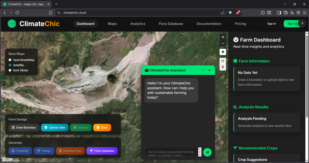
- ClimateChic.cloud: AI and GIS Services for Forestry
5.1 Organizational Positioning
While detailed technical documentation from ClimateChic.cloud is not fully public, available organizational profiles indicate a focus on climate-smart, evidence-based analytics for natural systems, including forestry and agroforestry landscapes. This positioning aligns with broader trends in climate technology that integrate AI, GIS, and cloud computing.
5.2 Likely Capabilities Based on Sector Trends
Based on sector-wide architectures and public descriptions, ClimateChic.cloud’s AI and GIS services likely include:
5.2.1 Remote Sensing Integration
Ingestion and processing of multi-source satellite imagery, automated land-cover mapping, and change detection workflows.
5.2.2 GeoAI-Driven Spatial Analytics
Machine learning classification of forest cover, deep learning-based disturbance detection, and predictive modeling of forest trajectories.
5.2.3 Decision Support Dashboards
Interactive web maps, time-series visualizations, alert systems, and exportable analytics for stakeholders.
5.2.4 APIs and Interoperability
Integration with external GIS systems, national databases, and climate modeling platforms.
5.3 Alignment with Climate-Smart Forestry
These capabilities align with climate-smart forestry principles, emphasizing resilience, adaptive management, and ecosystem service optimization under climate change.
- Comparative Landscape of AI Forestry Platforms
The AI and GIS forestry ecosystem includes:
Global cloud platforms that provide processing infrastructure but require custom model development
Specialized climate AI services focused on agriculture or meteorology
Academic tools demonstrating advanced modeling but lacking operational interfaces
ClimateChic.cloud likely differentiates itself by combining domain-specific forestry analytics with user-oriented decision support and cloud scalability.
- Challenges and Future Directions
7.1 Data and Model Limitations
Forest heterogeneity across biomes and species requires localized model calibration.
7.2 Scaling Across Jurisdictions
Differences in data standards, governance, and availability complicate large-scale deployment.
7.3 Trust, Transparency, and Verification
Operational systems must integrate uncertainty estimation and auditability.
7.4 Stakeholder Engagement
Future platforms may incorporate participatory and citizen-generated data streams.
- Conclusion
AI and GIS are no longer peripheral technologies in forestry; they are becoming central to how forests are monitored, managed, and adapted under climate change. The integration of machine learning, cloud computing, and geospatial analytics enables forest intelligence that surpasses traditional methods in scale, speed, and predictive power.
Platforms such as ClimateChic.cloud exemplify this transition toward integrated, AI-driven, and climate-smart forestry analytics. As digital transformation accelerates within the forestry sector, the continued development and adoption of AI-enabled GIS tools will be essential for sustaining forest ecosystems, supporting climate mitigation efforts, and enabling adaptive, evidence-based management.
Support Our Research
This research helps protect endangered species. Consider donating to continue our work.